Historic facilities on the Augustów Canal
PROJECT DESCRIPTION:
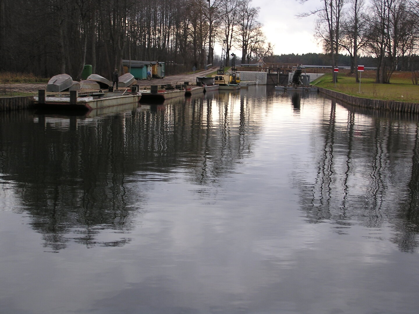
The Augustow Canal waterway is an engineering phenomenon from the nineteenth century (1825-1838). It was built in order to create an access to the Baltic Sea ports avoiding the mouth of the Vistula River which was at the time in the hands of Prussia.
Currently, it is a major tourist attraction and the most significant monument of the Augustow region, applying to be enrolled on the UNESCO World Cultural Heritage List. It connects the Vistula and the Niemen Rivers, using bandwidth of 12 Augustow lakes and two river valleys – Netta and Czarna Hancza. Our company is an author of the rehabilitation or reconstruction designs of the hydraulic facilities on the Augustow Canal.
TECHNICAL DATA:
- The Augustow Canal is formed by 45 km of artificial crosscuts, 35 km trained riverbeds,
- and 22 km of lakes.
- The canal is approximately 102.0 km long, of which 80 km are located on the territory of Poland, 18.6 km in Belarus, and 3.5 km in the border area.
- 18 navigation locks were constructed on the canal, of which 14 on the Polish territory, one in the border zone and 3 in Belarus. They allow to overcome the difference in water levels of 54.04 m.
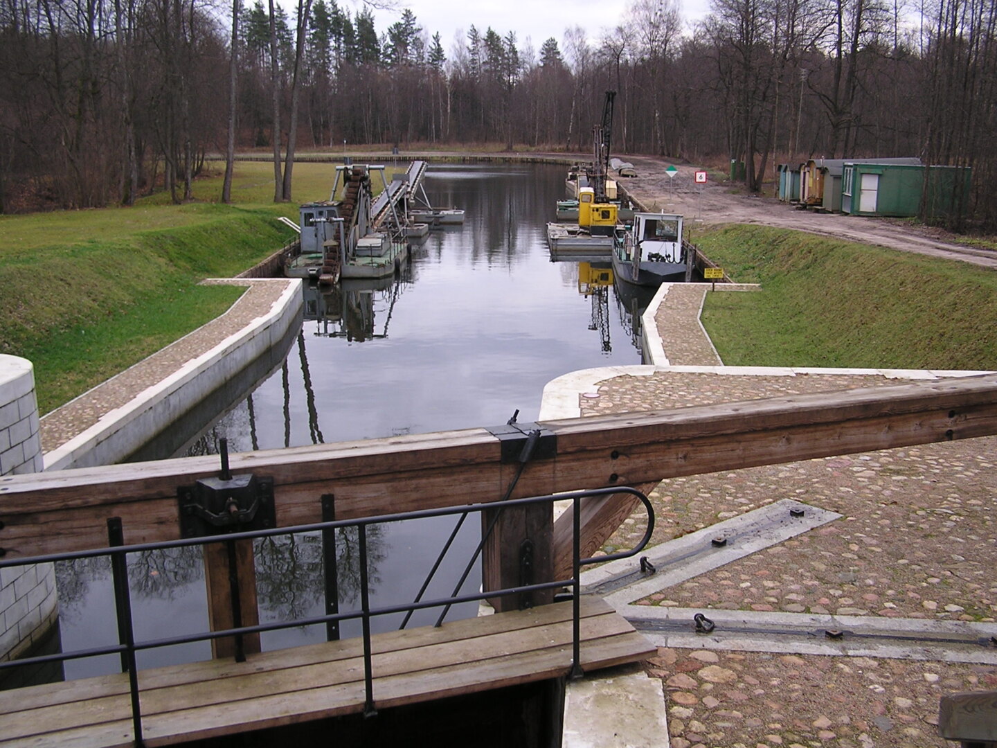
- Reconstructed hydraulic ficilities:
- Debowo navigation lock – difference in water levels 3,11 m; usable length 43,56 m, width 6.04 m; manual drive; in the vicinity of the navigation lock there are a vertical lift gate weir and discharge outlet, used to propel a small hydropower plant; buildings from the early twentieth century constitute a part of the navigation lock unit
- Przewiez navigation lock – connects Biale Lake with Studzienniczne Lake; usable length 46.17 m, width 5.96 m; water head 1.41 m, lockage time 11 minutes
- Gorczyca navigation lock – usable length 43.23 m, width 5.95 m, max water head 3.26 m
- Paniewo navigation lock – two-chamber structure; usable length 44.41 i 43.64 m, width 6.40 m; water head 6.69 m; hight of the lock walls exceeds 10 m; founded on a wooden pile bent (low bearing foundation)
- navigation lock and weir with bridges in Perkuc – located on the canal between Krzywe and Mikaszewo Lakes; water head 3.21 m
- navigation lock and weir with bridges in Tartak – one-chamber structure of the lock, max water head 2.02 m
- Kudrynki navigation lock – one-chamber structure with max water head of 2.17m; brick gated weir on the side canal, mitral gates
- Kurzyniec navigation lock – one-chamber structure, located along the Polish-Belarussian border (state frontier along the longitudinal axis of the lock); water head 2.98 m; wooden drawbridge over the lock
- Wolkuszek weir – located along the Polish-Belarussian border; length 12.5 m, span of the weir 3 x1,5 m, max water head 2.35 m, wooden mitral gates 1.5 x 2.45 m
SCOPE OF SERVICES:
- renovation based on the design documentation of Debowo navigation lock
- technical assumptions of refurbishment and design of strenghtening of the foundation under the lock of Przewiez navigation lock
- renovation based on the design documentation of Gorczyca navigation lock
- guidelines for rehabilitation works and design of improvement of the lock’s foundation stability for Paniewo navigation lock
- comprehensive technical documentation of refurbishment of the navigation lock with the weir and steel bridges on the community road in Perkuc navigation lock
- comprehensive technical documentation of refurbishment of the navigation lock with the weir and steel bridges on the community road in Tartak navigation lock
- comprehensive design documentation for the reconstruction Kudrynki navigation lock
- comprehensive design documentation for the reconstruction of Kurzyniec navigation lock with author’s supervision
- comprehensive design documentation for reconstruction of the Wolkuszek weir included construction of the wooden sheet piling, strenghtening of the subsoil of the weir and existing structure of the walls, reconstruction of the wooden elements (mitral gates) and their casing, as well as assembly of the measuring-control system


Project
Historic facilities on the Augustów Canal
Client
The State Water Holding Polish Waters - Regional Water Management Authority in Warsaw
Location
at 0.35÷85.00 km of the Augustow Canal
Time frame
1997 - 2012
 Polski
 English