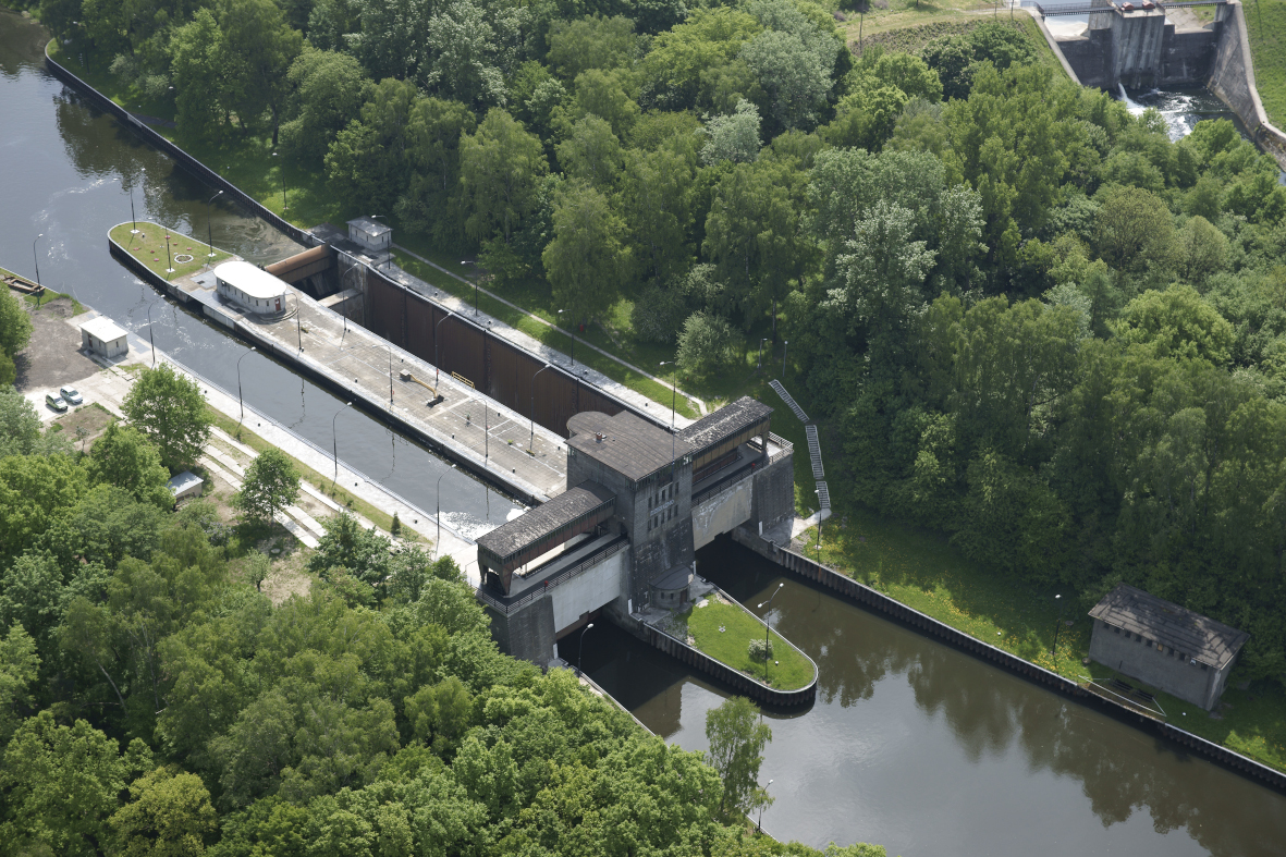
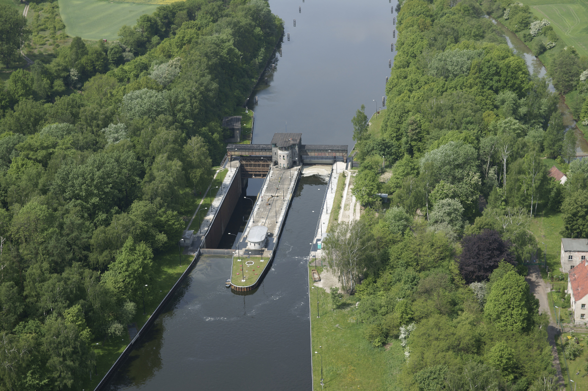
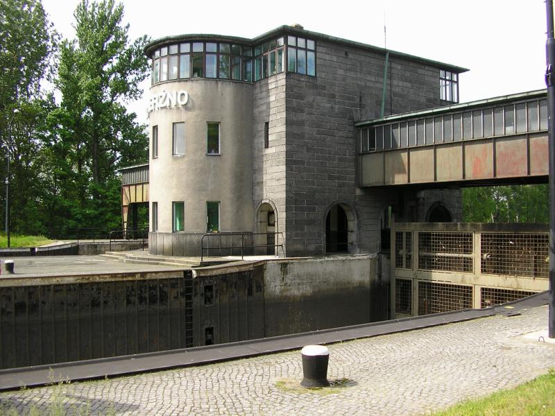
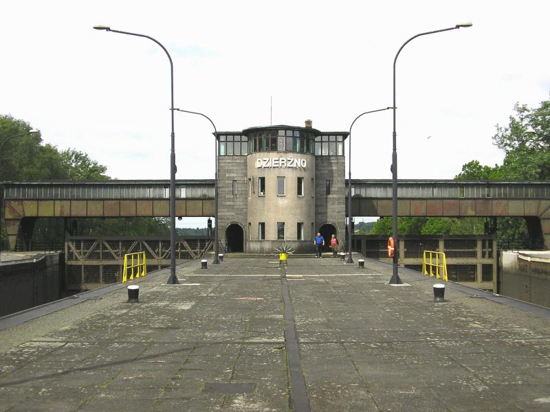
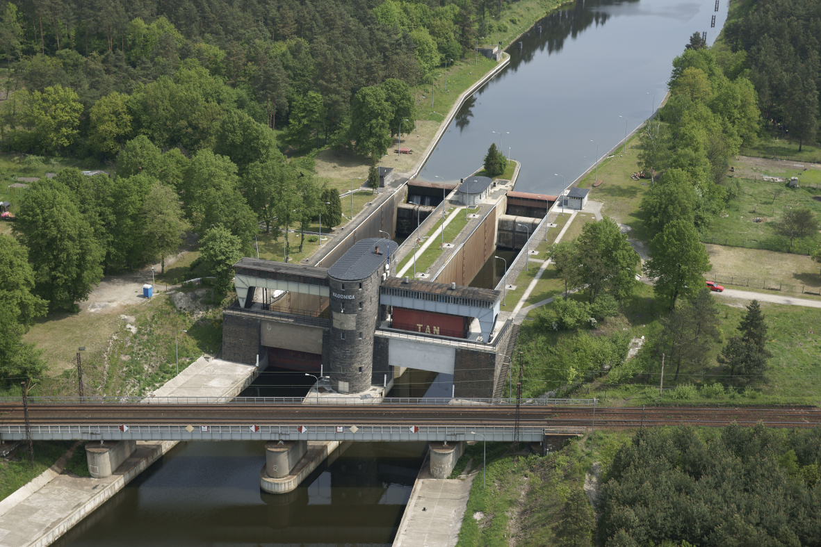
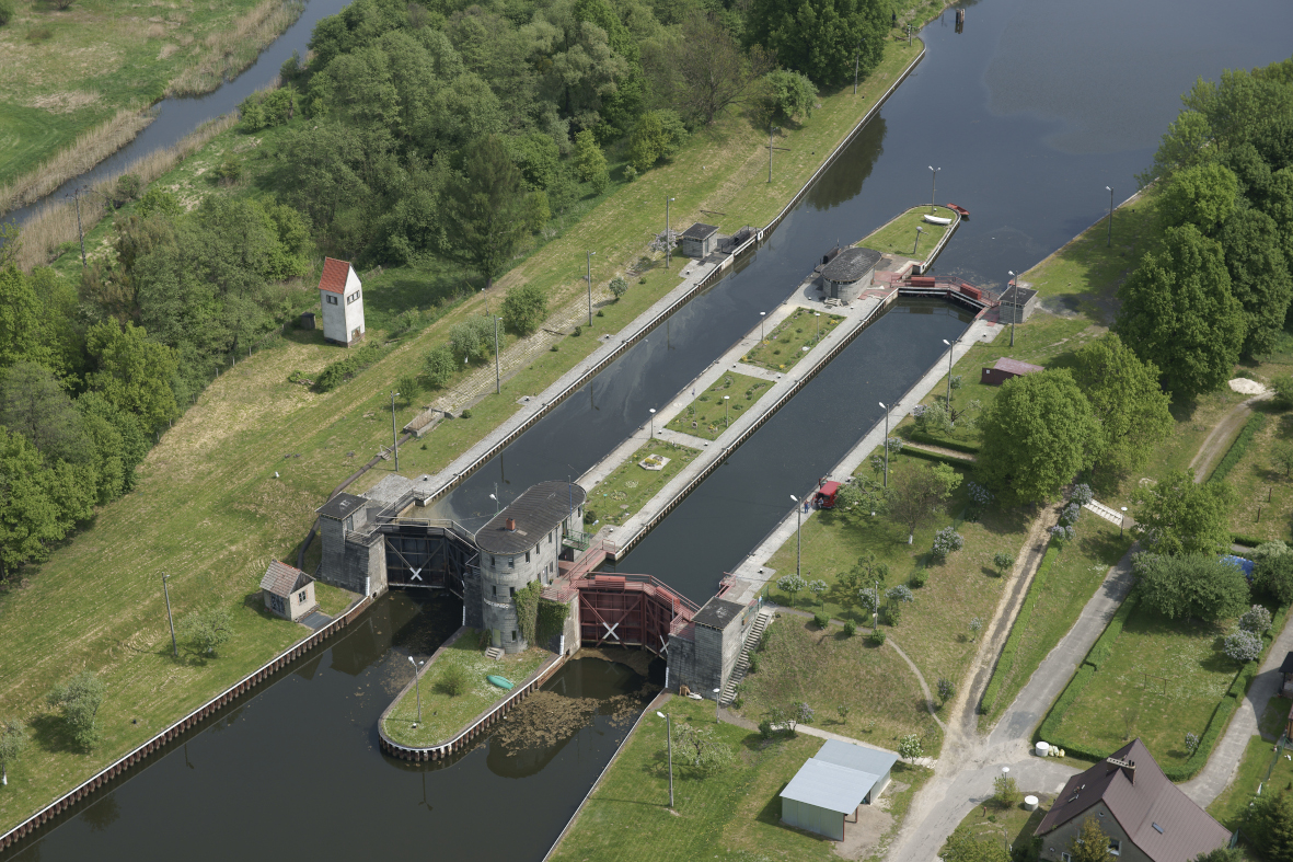
Navigation locks on the Gliwice Canal
PROJECT DESCRIPTION:
The aim of the project was to adapt the Gliwice Canal to the III class of a waterway by improving the technical condition and safety of the structures and devices.
TECHNICAL DATA:
- The Canal is 40.60 km long, it reaches the maximum depth of 3.50 m, and the difference in water levels at the beginning and the end is 43.60 m.
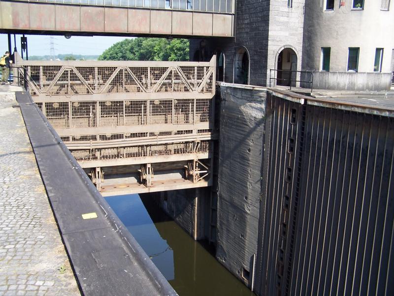
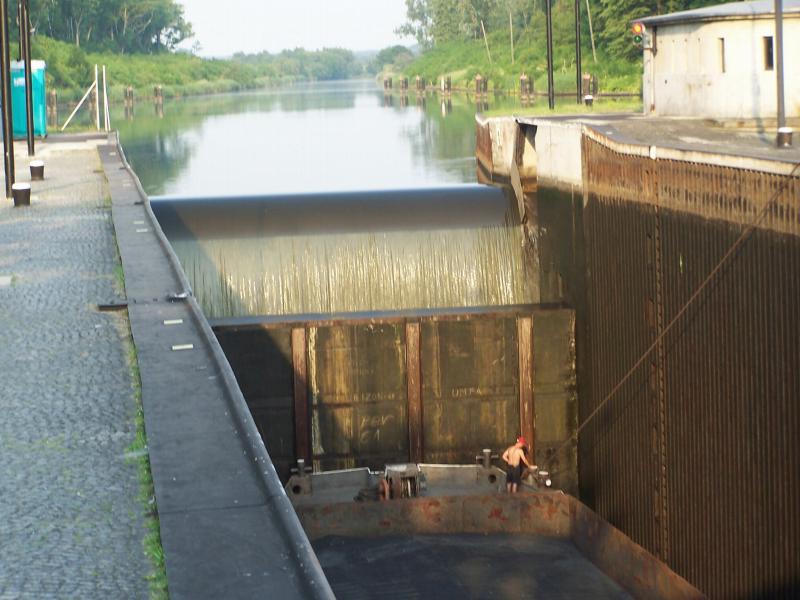
- Overcoming the difference in water levels by floating vessels is regulated by 12 two-chamber locks, arranged in pairs at 6 barrages, each of them 71.5 m long (L), 12.0 m wide (B), and with the head from 4.2 m to 10.4 m.
- LABEDY NAVIGATION LOCK
difference in water levels: 4.20 m
length: 71.50 m
volume of water used for lockage: 3900.00 m³ - DZIERZNO NAVIGATION LOCK
difference in water levels: 10.30 m
length: 71.50 m
volume of water used for for lockage: 9500,00 m³ - RUDZINIEC NAVIGATION LOCK
difference in water levels: 6.25 m
length: 71.40 m
volume of water used for for lockage: 5800.00 m³ - KLODNICA NAVIGATION LOCK
difference in water levels: 10.40 m
length: 71.80 m
volume of water used for lockage: 9500.00 m³
SCOPE OF SERVICES:
- comprehensive technical documentation,
- construction supervision on behalf of the author
- as-built drawings


Project
Navigation locks on the Gliwice Canal
Client
The State Water Holding Polish Waters - Regional Water Management Authority in Gliwice
Location
Silesia Voivodship, Gliwice District, Gliwice Municipality, Rudzinieca and Pyskowice, Opole Voivodship, Kedzierzyn-Kozle District, Kedzierzyn-Kozle Municipality, Poland
Time frame
2010 - 2013
 Polski
 English